
… Govt, CDC teams to visit area today
…GDF to assist evacuation of residents
By Lakhram Bhagirat
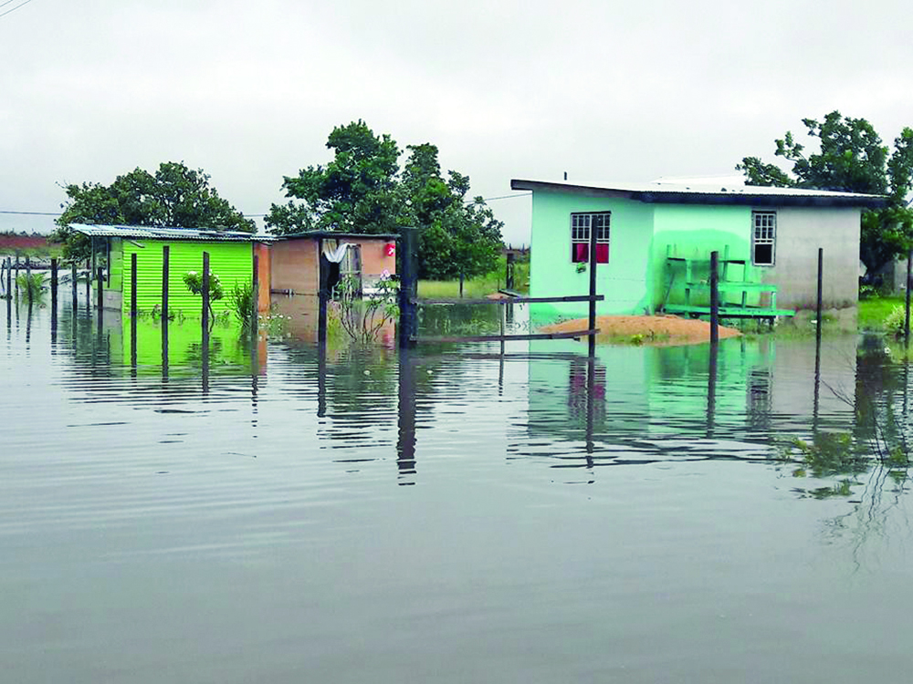
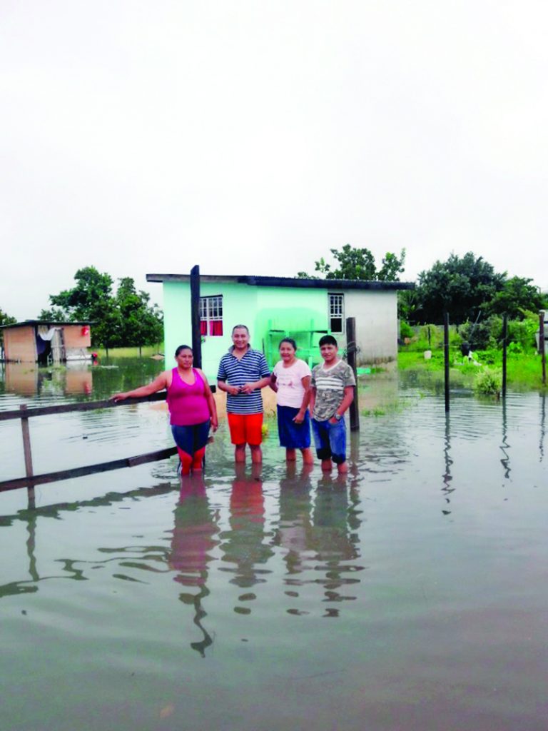
Several parts of Region Nine (Upper Takutu-Upper Essequibo) are under water following heavy rainfall over the weekend, which resulted in at least two families being evacuated. However, when contacted Sunday, Regional Executive Officer (REO) Kerwin Ward said he was unaware of any flooding in the Region.
Up to press time on Sunday, the floodwaters were rising rapidly. Residents are taking precautions to ensure their homes and property are not destroyed by the water. Guyana Times understands that the community of Tabatinga, Lethem in Central Rupununi is completely under water along with several other parts of South Rupununi and the Pakaraimas.
When this publication contacted Ward on Sunday, he said he was currently out of the Region, but indicated that his officers have not reported any flooding to him. In addition, several efforts to contact Regional Chairman Brian Allicock were unsuccessful.
Opposition parliamentarian for the Hinterland Regions, Alister Charlie told this publication that the flooding was due to ‘heavy and persistent’ rainfall over the weekend. He said the Rupununi and Takutu Rivers have overtopped their banks, forcing water into the residential areas and, as a result, Deep South Rupununi and South Pakaraimas have been shut off.
The residents say the water have been rising since Saturday and have risen to almost 14 inches in some parts. They added that owing to the heavy rainfall, the water is still rapidly rising. Some residents chastised the Regional Administration for their lack of response and information as it relates to relief efforts.
Meanwhile, the controversial $60 million Tabatinga bridge was also under water making it impassable and, according to Charlie, the residents are of the view that there was not a dire need for the bridge, but there is an immediate need for the maintenance of roads within the Tabatinga Housing Scheme. The roads in Tabatinga are in a deplorable state and most times are a major hazard to road users.
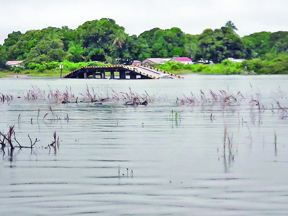
The Mayor of the municipality of Lethem, Carlton Beckles, had said in his justification for constructing the bridge that this would ease traffic congestion at the main Tabatinga Bridge. However, residents argue that there is not any traffic congestion in the area. No consultations with the residents of Lethem were said to have been done prior to the construction of the bridge.
The areas threatened are Tabatinga, Culvert City and St Ignatius. A CDC Team will depart Ogle this morning (Monday) and will be on a reconnaissance mission. The team will also take in sanitation relief supplies. A temporary shelter is being set up at the Amerindian Hostel.
Following an emergency meeting last evening with Region 9 RDC officials, Lethem town council officials and others, the Mayor of Lethem, Mr. Beckles, provided the following report through the CDC:
* Emergency shelters are activated at the following locations – Arapiama Primary School, the Amerindian Hostel and Culvert City Nursery School.
* Drivers and vehicles are on standby to evacuate affected persons to the shelters.
* Seven telephone numbers were made public via Radio Lethem for persons to call in for assistance.
* The GDF is assisting with evacuation.
* The Regional Chairman has reported that almost all the toshoas and village captains in the region reported that their farmlands are under water.
* Parishara, Nappi and Hiowa are cut off from Lethem because the road is almost completely under water.

Since the beginning of the May-June rainy season, citizens were warned to expect higher than normal rainfall and to take the necessary precautions. However, since it began, several villages have experienced major flooding and some are still trying to rebuild after the floods. The hard-hit communities were mostly limited to Regions Seven (Cuyuni-Mazaruni) and 8 (Potaro-Siparuni) as the water washed away houses, but fortunately, there were no casualties.
One such village is Chenapau in Region Eight. Water levels in the Amerindian village rose to approximately 20 feet in some areas and the Potaro River remains flooded owing to the heavy rains the Region is currently experiencing.
The residents there are fearful of rebuilding since the threat of another flood is looming on the horizon. Roadways and access to the other zones in the village remain flooded. Villagers are also accusing the Government of neglecting them since the water receded from their lands.
They complained that following the initial relief supplies, the Government has yet to offer any additional supplies to the community as they are still battling to recuperate. Farms in the village were washed away and residents were finding it difficult to restart.