
…says 26,000 miles searched as Coast Guard tracked distress signals
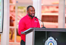
On day five of the Commission of Inquiry (CoI) into the MV Barima tragedy, Guyana Defence Force (GDF) Coast Guard Commanding Officer Commander David Shamsudeen testified that electronic charts, sea-condition assessments, tidal patterns and lessons from previous operations guided the search for the vessel.

The commanding officer made these remarks at the Arthur Chung Conference Centre on Tuesday morning.
He said the Coast Guard used several sources of information to develop an understanding of the search area and inform its decisions. He explained that the Maritime Operations Centre (MOC), working alongside the Maritime Rescue Coordination Centre (MRCC), analysed available information to determine search directions and deploy vessels during the operation.
Shamsudeen explained that the search area was divided into sub-sectors, with vessels assigned to search in specific directions from the reported location.
When asked about the size of the main search area, he testified that it covered approximately 26,000 square nautical miles for the offshore patrol vessels (OPVs).
However, for smaller vessels, the Coast Guard focused on an area with a six-nautical-mile radius extending towards the shoreline.
He also explained that, during the early stages of the operation, when distress signals were being received, the Coast Guard followed its standard operating procedures.
Shamsudeen said personnel relied on the Automatic Identification System (AIS), Skylight and other vessel-monitoring tools to identify vessels operating in the areas where the distress signals were reported.
He also used Google Earth to plot the coordinates received and compare them with the eventual wreck site. His analysis showed that the first coordinate was approximately 12.3 nautical miles from the wreck, while the second was about four nautical miles away.
“Those coordinates received were plotted on the Google Earth platform. The first coordinate was received at 22:51h. I used Google Earth to map all the locations we would have received, including the distress signals as well as the actual site of the wreck. This gives us the location and the distance from the actual wreck,” he explained.
He noted that this formed only part of the analysis, since the Coast Guard could not initially establish whether the distress signals originated from the MV Barima.
“We went ahead and conducted an analysis of our vessel-monitoring system in the Maritime Operations Centre,” he said.
He added that AIS and Skylight were used to verify whether any vessels were operating in the areas where the signals were received.
“The objective was to identify those vessels. If there were any vessels in the area, we would have been able to identify them and determine whether they could have been the ones on scene until the Coast Guard arrived,” Shamsudeen testified.
As part of the CoI’s mandate, Justice Godfrey Phillip Smith, Chairman of the CoI, reiterated that their objective was to identify ways to prevent a similar tragedy from occurring again.
He asked Shamsudeen whether he believed that a post-incident report on the MV Barima would assist the presidential CoI in comprehensively examining how and why the vessel capsized and sank and in fulfilling its mandate.
He stated that he understood the importance of determining the circumstances surrounding the tragedy, particularly given the loss of several lives.
“I understand that it is important for us as a nation to understand the hows and whys, especially in an incident of this nature, where several people lost their lives, something that we would never want to be a part of.”
However, he maintained that his responsibilities were focused on maritime search-and-rescue operations rather than determining the causes of the incident.
“But I stand on the fact that, from where I sit, I am directed at maritime search-and-rescue operations, and not necessarily the how and why with regard to the MV Barima incident. If we talk about search and rescue, then my report would be more than helpful in explaining how the search-and-rescue operation itself unfolded. But the hows and whys – my report is not going to speak to that.”
The MV Barima capsized and sank on July 18, 2026, approximately 9.3 nautical miles off Devonshire Castle on the Essequibo Coast.
The passenger and cargo ferry had departed the Kingston Goods Wharf in Georgetown at about 15:15h on its scheduled journey to Port Kaituma in the North West District.
However, at about 23:01h, the vessel transmitted a distress signal after encountering difficulties off the Essequibo Coast, near the mouth of the Pomeroon River.
A total of 179 persons, including 18 crew members, were on board.
The disaster claimed 73 lives, while 76 persons survived, and approximately 30 remain unaccounted for.
The CoI was established to examine the causes and contributing factors of the disaster, including the vessel’s loading, passenger boarding procedures, conditions on board, seaworthiness, maintenance history, compliance with maritime laws and safety standards, the conduct and competence of the master and crew, passenger management and lifesaving arrangements, as well as the roles of weather, sea conditions and other operational factors.
The Commission will also review the search, rescue and recovery operations, assessing the adequacy, coordination and effectiveness of the response by all agencies and stakeholders involved.
Discover more from Guyana Times
Subscribe to get the latest posts sent to your email.